Latest topics
» Battle of L.A. - UFO over Los Angeles 1942by easynow Sat Mar 23, 2024 2:13 pm
» Secret 1990 Calvine UFO photo leaked
by easynow Sun Mar 17, 2024 5:22 pm
» U.S. Military has Secret UFO retrieval program
by easynow Sun Jan 21, 2024 6:47 pm
» Video: Astronauts' Reports of UFO are Silenced
by easynow Mon Dec 11, 2023 5:49 pm
» Customs and Border Patrol UAP Videos
by SpaceBot Fri Sep 22, 2023 7:25 pm
Apollo 15 - Mons Hadley Cement Model
3 posters
Page 1 of 1
 Apollo 15 - Mons Hadley Cement Model
@easynow: I was going through your collection and recognized this video as one of the projects LunaCognita was working on. Thanks for making the video available, by now that is probably the right thing to do. For further insight and/or clarification, I am adding the comprehensive explanation Luna provided me with (see below). Thanks Luna, we miss you... 
Mons Hadley is a massif in the northern portion of the Montes Apenninus, a range in the northern hemisphere of the Moon. The selenographic coordinates of this peak are 26.5° N, 4.7° E. It has a height of 4.6 km and a maximum diameter of 25 km at the base.
To the southwest of this mountain is a valley that served as the landing site for the Apollo 15 expedition. To the southwest of this same valley is the slightly smaller Mons Hadley Delta (d) peak with a height of about 3.5 km. The coordinates of this peak are 25.8° N, 3.8° E. To the west of these peaks is the sinuous Rima Hadley rille where the Fallen Astronaut memorial has been placed in memory of those astronauts who died in the advancement of space exploration.
Link - http://en.wikipedia.org/wiki/Mons_Hadley
Video Credit - LunaCognita
MP
LunaCognita wrote:
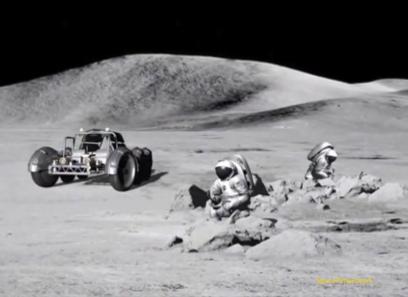
My goal with this particular video I am working on is to hopefully begin to explain that the massifs and far horizon vertical relief we see in the Apollo lunar surface footage are in fact just small scale models of the massifs that were made out of cement! Firstly, NASA/BellComm admit they made these models before every mission - there is no debate about that. Officially, the excuse was that they made these small-scale models for "simulation" purposes, but always remember that there is NO difference between "simulation" and "fakery". A simulator is designed to accurately "fake" a scene, and with Apollo, many of the lies and techniques used to hide the truth were hidden behind the idea that they were being built for official simulation purposes.
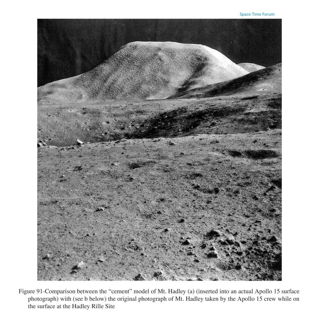
These small-scale cement models I talk about in this video were built by the USGS-BOA (United States Geologic Survey - Branch of Astrogeology) using sanitized topographic data sets that were supplied by BellComm through the MSC Mapping Sciences Branch and the US Army TOPOCOM (TOPOgraphic COMmand). I actually show a few archive images of a few small cement models in this video, including one showing "Mons Hadley" at the Apollo 15 landing site at Hadley Rille that shows how they were able to film and insert these small models into the lunar surface imagery to cover up what was REALLY on the far horizon.
I also begin to explain in this video how BellComm's computer-generated 3D Digital Elevation Models (DEM) were absolutely vital to them being able to pull this off. This particular video cuts off before I get deeper into the evidence about that (remember that this video is just an incomplete draft that is only halfway finished), but these computer graphics I am talking about allowed them to create accurate templates so they could properly align the far horizon vertical relief to make sure every scene was "photogrammetrically correct".
Now, photogrammetric alignment was INCREDIBLY important for NASA/BellComm to take into account when they were constructing these composites, because you must always keep in mind that they were not compositing one or two photographs during the missions, but rather they were doing many images, and all those lunar surface images had to be constructed in such a way that if you compared them to each other, the backgrounds would be properly aligned and shown in their proper declared positions. They had to have a way of making sure that the small-scale models of the massifs were always properly aligned in every image, showing the proper field of view with the proper line of sight considerations AND sun angle/shadow effects. This incredibly important alignment criteria was accomplished using BellComm's computer-generated DEM graphics, which provided an accurate pre-flight survey of the size and shape of the declared vertical relief that NASA wants us to believe was visible on the horizon around each landing site.
Basically, the USGS-BOA built the small-scale models of the vertical relief out of cement, based on sanitized topographic data provided by BellComm. They built models of both the real vertical relief that is up there (those models were highly classified) because they showed the real view of the horizon. Those real models were covertly used in the real simulators to train the astronauts, BUT they also built sanitized versions of every massif model that were designed to not show us anything that we, the public, were not supposed to see up there. These sanitized models are what we see on the horizon of every image shot from the lunar surface in NASA's public archives.
These sanitized models were then each filmed separately (by themselves) on a composite film set with a single collimated light source being used to create the desired sun/shadow effects. Remember, each of these models was less than 1 meter tall, so there was no "huge film set in the desert" like some people claim was how they faked this imagery. It was all done on a small film set using small-scale models of the massifs. These photos of the sanitized cement models they took were then cropped out and composited into the public archive frames in order to cover up the real far horizon vertical relief. Because these models were built from the sanitized DEM, they have the same basic shape profile as the real massifs up there on the Moon (they were just built to not show us anything we were not supposed to see), so they could be "cropped and dropped" right into the Apollo archive imagery to accurately cover up the real vertical relief.
(...) The BellComm 3-D computer generated "horizon views" (made BEFORE every mission) were designed to serve as "templates" to align the cement models when they were being inserted into the scene so they would ensure photogrammetrically accurate placement. Basically, the computer graphics were used as overlay templates to make sure the cement models were properly aligned and would cover up what was really there, and would match the depth-of-field issues as well.
This really is a massive part of the whole Apollo coverup, and at the very least, this evidence shows that NASA/DoD ADMITTEDLY had the capability to do everything I am saying they did. All the tools and technology admittedly existed, and admittedly was being used for "simulation" purposes before every mission. These same techniques were also used to lie to the world about what is really up there, showing us a simplistic, sanitized view of the far horizon vertical relief around every Apollo landing site.

Max Peck- Posts : 127
 Re: Apollo 15 - Mons Hadley Cement Model
Images discussed in the video...
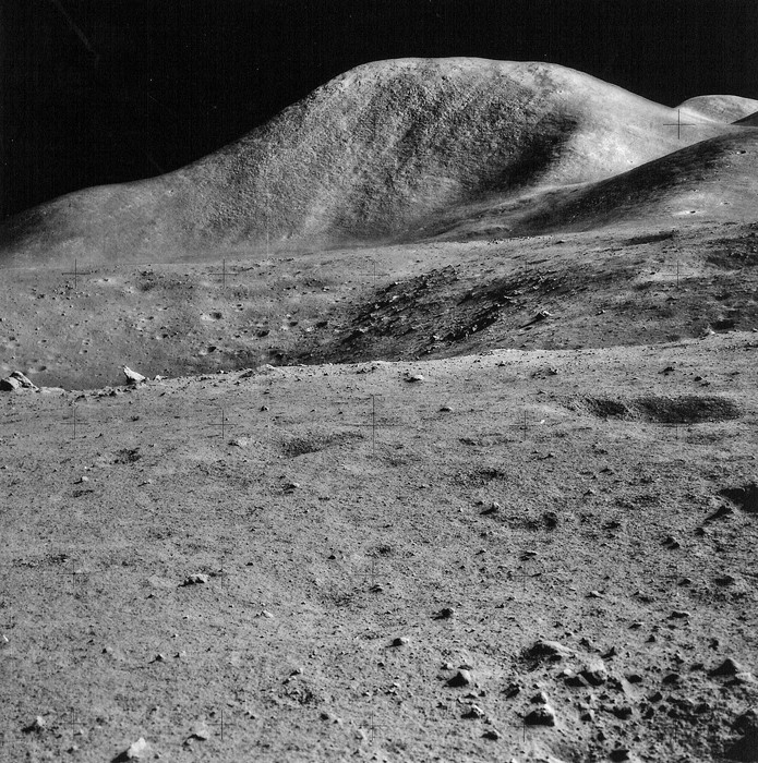
Comparison between the "cement" model of Mt. Hadley (inserted into an actual Apollo 15 surface photograph) with (see below) the original photograph of Mt. Hadley taken by the Apollo 15 crew while on the surface at the Hadley Rille Site. USGS Open-File Report 2005-1190, Figure 091a.
Link - https://i.servimg.com/u/f39/18/67/69/30/pap00910.jpg
Source - http://libraryphoto.cr.usgs.gov/htmllib/btch545/btch545j/btch545z/pap0091a.jpg
Source - http://libraryphoto.cr.usgs.gov/cgi-bin/show_picture.cgi?ID=ID.%20Project%20Apollo%20%281960-1973%29%20091a
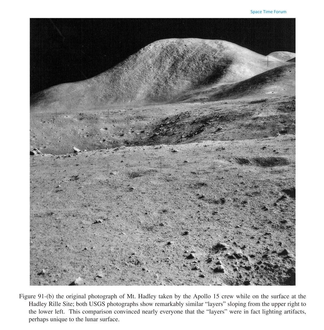
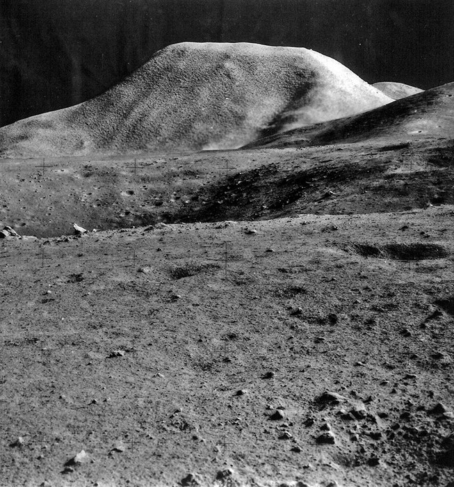
The original photograph of Mt. Hadley taken by the Apollo 15 crew while on the surface at the Hadley Rille Site; both USGS photographs show remarkably similar "layers" sloping from the upper right to the lower left. This comparison convinced nearly everyone that the "layers" were in fact lighting artifacts, perhaps unique to the lunar surface. USGS Open-File Report 2005-1190, Figure 091b.
Link - https://i.servimg.com/u/f39/18/67/69/30/pap00911.jpg
Source - http://libraryphoto.cr.usgs.gov/htmllib/btch545/btch545j/btch545z/pap0091b.jpg
Source - http://libraryphoto.cr.usgs.gov/cgi-bin/show_picture.cgi?ID=ID.%20Project%20Apollo%20%281960-1973%29%20091b
EDIT: The NASA Image ID of this photo is AS15-90-12244.
Last edited by Max Peck on Mon Jun 30, 2014 6:28 pm; edited 1 time in total (Reason for editing : NASA Image ID added)

Max Peck- Posts : 127
 Re: Apollo 15 - Mons Hadley Cement Model
This video has been available for so many years that I'm having a hard time believing that I've never seen it before. 
Thanks for creating this post and for adding Luna's description.
Thanks for creating this post and for adding Luna's description.
ner0- Posts : 21
 Re: Apollo 15 - Mons Hadley Cement Model
Thread note: topic moved as requested
Very nice work Max, thanks for posting !
Here's the PDF links LunaCognita mentioned in the video ...
The file is of2005-1190_figs_080-101.pdf (116 pages; 62.9 MB)
And contains the two relevant images ...
Cheers
Very nice work Max, thanks for posting !
Here's the PDF links LunaCognita mentioned in the video ...
The U.S. Geological Survey, Branch of Astrogeology—A Chronology of Activities from Conception through the End of Project Apollo (1960-1973)
Link - http://pubs.usgs.gov/of/2005/1190/
The file is of2005-1190_figs_080-101.pdf (116 pages; 62.9 MB)
And contains the two relevant images ...
From Pg. 52
https://i.servimg.com/u/f39/15/84/15/12/page5211.jpg
From Pg. 53
https://i.servimg.com/u/f39/15/84/15/12/page5311.jpg

https://i.servimg.com/u/f39/15/84/15/12/page5211.jpg
From Pg. 53

https://i.servimg.com/u/f39/15/84/15/12/page5311.jpg
Cheers

easynow- Posts : 790
 Re: Apollo 15 - Mons Hadley Cement Model
Not sure what happened to the music/audio on this video

easynow- Posts : 790
 Similar topics
» CBS News - Apollo 8 Earth Model
» Apollo 12 over Mösting crater
» Apollo Subsatellites
» Restored Apollo 11 EVA
» The Incredible Journey of Apollo 12
» Apollo 12 over Mösting crater
» Apollo Subsatellites
» Restored Apollo 11 EVA
» The Incredible Journey of Apollo 12
Page 1 of 1
Permissions in this forum:
You cannot reply to topics in this forum
 Home
Home Gab Social
 Twitter
 Youtube

 interesting illustration image ...